Locating Sound Installations
- Amy F. Docherty

- Oct 21, 2020
- 3 min read
The Possible Sites
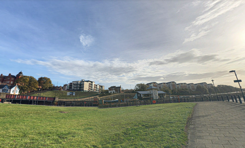
Site 01_Malmo Wharf
Previously home to the staiths of the Ouseburn, Malmo Wharf is now a disused piece of land at the prominent convergence point of the river Ouseburn and the river Tyne.
Open on all sides, the sound installation may either spread further than other locations or be muted by the noises of the nearby quayside and river Tyne. It would be interesting to understand more of how an entirely open space effects sound when there are no materials for the noise to reverberate off.
Site 02_Glasshouse Bridge
The high level Glasshouse Bridge which lies some 50 metres to the north of the mouth of the Ouseburn's name 'Glasshouse' came from the numerous glass-making houses which were established on the east side of the Ouseburn mouth in the 17th and 18th centuries. First visible on Hutton's map of Newcastle (1770), the stone bridge over the Ouseburn referred to as 'Glass House Bridge' is thought to have been built in around 1609 and was rebuilt three times between 1619 and 1908 when it was finally demolished as the quayside was extended.
Shielded by the brickwork bridge on two of the four sides and covered by a brickwork arch above, the sound installation will have many areas to reverberate sound from. This would allow for the sound piece to echo, creating more layers of sound to allow for the already layered sound piece to create more and varied natural manipulations.
Site 03_Hume Street
When the Maling pottery to Newcastle in 1817 the then owner, Robert Maling, began to mark pieces with his surname. Their output seems to have been mainly simple, domestic wares made for use by the local working people but the Maling factory was an active part of the Ouseburn until its closure. The pottery making process, which included everything from casting to decorating, was completed in the factory, the site of which is now home to multiple homes and allotments as well as the old Maling Hall which has now been converted into a pub.
The area is surrounded by the new housing area, and historic Maling Hall. These large brick buildings will both allow for reverberation between them as well as an open air quality to the space which may effect the sound travelling.
Site 04_Industrial Estate
The modern industrial estate of the Ouseburn was historically on the site of the Ouseburn Engine Works. In the modern day, the estate houses businesses such as Print North East and Out There Brewing Co.
Relatively open, the sound may dissipate from here, although it is of interest to see how this will effect the noise within the area.
Site 05_Lime Street
Caught between the old chimney and what was the Ouseburn Mill Flax Store, this site is cornered between the longstanding chimney and the Cluny, a music venue.
The site is open to one side and clear above. Situating the sound installation in this area will allow for the sound to reverberate off one area and allow for the echoes to spread further to the opposite edge.
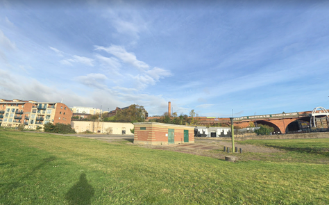
Site 06_Ouseburn Viaduct
Underneath the viaduct which dates back to the late 1830s and carries the East Coast Main Line over the Ouseburn Valley through the East End of Newcastle, was historically a refuse heap. The highest point to which the Medium Tides flow, beneath the viaduct is now a green space with a pathway through it. The viaaduct iself was designed by architects John and Benjamin Green who are responsible for many local landmarks such as Greys Monumant, Penshaw Monument and the Newcastle Theatre Royal. The arches were rebuilt in iron in 1867-1869 and the two-tracked line was four-tracked in 1887 with the addition of a new viaduct next to and north of the original.
The sound piece would be in the deepest part of the valley in this position. Although technically higher up than the rest of the Ouseburn, the valley's hillsides are much steeper in this position allowing for the sound to reverberate in a completely different way to each other space.
Tactile Maps
In an attempt to address the obvious flaw in visualising sound in a place for mapping its position, I was interested in Chris Downey's experiences with embossing plans to create tactile maps to help him to visualise the spaces at various scales through touch. To attempt to recreate this, I firstly decided to sew through the printed maps without thread to allow for the the needle to pierce the map and paper beneath it, leaving a braille-like textured line where the needle has pushed through.
Trial Run - Site 06_Ouseburn Viaduct
The initial trial of this was successful in the sense that it left a tactile marking where the map lines were, however the low gsm copier paper didn't have the resistance to hold together, meaning the paper instead tore leaving confusing gaps in areas of the lines. To counteract this, I'll have another attempt with thicker cardstock and with a wider needle setting.


Comments